Royal Observatory Greenwich
2009
N 51° 28' 40.1247" W 00° 00' 5.301"
Royal Observatory, Greenwich
- Built in 1676 to determine longitude at sea.
- The link between stars, time and navigation.
- The world's prime meridian since 1884.
- The basis for Greenwich Mean Time (GMT).
- The place where East and West meet.
Arriving in Greenwich

In November 2009, Marjan and I visited London. A visit to Greenwich was also on the itinerary.
Greenwich lies on the south bank of the Thames and can be reached in several ways.
This is the entrance to the pedestrian tunnel. On the other side you can see the exit.
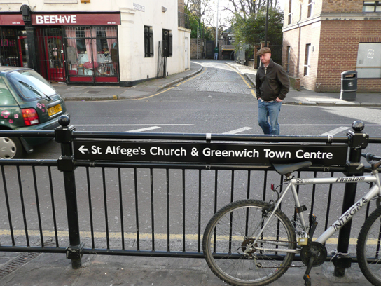
You can also take the Underground (the Tube), which is what we did.
As soon as you come out of the station, there's already a signpost pointing the way.


Soon the buildings of the Naval College and the Maritime Museum come into view.
Built in 1634 as a hospital, it was converted into a naval academy in 1883.

The Naval College buildings, with their clock and wind rose, stand along the Thames in the
'Naval College Gardens', which merge into Greenwich Park.
Below: the Naval College on the Thames, with Queen's House in the foreground.

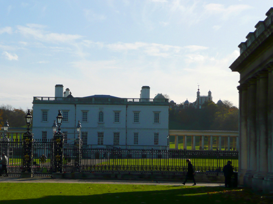
Queen's House (1638). In the distance, up on the hill, you can already see the Royal Observatory.
The Quest for Longitude
To determine your position on Earth, you need reference points - zero points from which to
calculate. For latitude, that reference is the equator. For longitude, every traveller once
chose their own zero point.
To establish your latitude, you measure the height of the Pole Star with a sextant, and that
gives you your latitude directly.
At sea, that same trick doesn't work for longitude, since there's no natural reference point for
it there. Taking a star sighting works fine, so latitude was never really the problem.
To determine longitude at sea, sailors did the following:
- Mark your current (harbour) position on the chart.
- Start your timekeeper - an hourglass, for instance - the moment you depart.
- Measure the ship's speed at set intervals. To do this, a wooden log tied to a knotted rope was
thrown into the water. By timing how the rope ran out, the ship's speed (in knots) could be
determined.
- Speed divided by time gives the distance travelled.
- Draw an arc on the chart (with a radius equal to the calculated distance) centred on the last
known position.
- Draw the horizontal line of latitude (calculated from the star's position).
- The intersection is your new position.
From the 15th century onward, accurate positioning became increasingly difficult. Seafaring
nations were now sailing the entire globe, and there were no reliable clocks. Before the
mechanical clock was invented, sailors relied on hourglasses. Huygens' pendulum clock (1656)
couldn't be used at sea.

Building the Royal Observatory
King Charles II was convinced the solution had to be found in astronomy. He had heard from a
Frenchman that the Moon could serve as a reference point. He set up a commission that included
Robert Hooke, Christopher Wren and John Flamsteed. The latter convinced Charles that, given the
current accuracy of lunar and stellar positions, this wasn't yet feasible.
Charles II then commissioned the construction of an observatory to carry out the accurate
measurements needed.
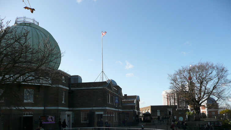
Christopher Wren, architect and astronomer, designed the observatory on the site of a ruined
castle.
As is still often the case today, the building had to cost as little as possible. Old stones from
the castle were reused, while wood and lead came from an old gatehouse at the Tower of London.
Robert Hooke advised on the layout. It included living and working quarters and a 'Star Room',
the Octagon Room. By the time John Flamsteed moved in in December 1676, construction had taken a
year and cost 520 pounds. It became known as 'Flamsteed House'.

In the early days there were no domes. The telescope, invented in 1608, stood outside in the
courtyard.
Flamsteed's telescope was 18.5 metres long and towered far above the building.


Timekeeping and the Time Ball

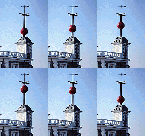
As mentioned earlier, having the correct time became an indispensable tool. In 1833, a 'Time
Ball' was installed on Flamsteed House. It's still raised halfway at 12:55 and to the top at
12:58 every day. At exactly 1:00 pm, the ball drops. All ships on the Thames could then set their
clocks accordingly.
This happens at 1 pm rather than noon, because at midday the crew would be busy taking a
noon sun sighting.
From 1836 onward, the time from the gatehouse (on the left) was carried into the city on portable
clocks. Women delivered the 'current' time daily to subscribers throughout London.

This does give you a special feeling.


The Altazimuth Pavilion, with Halley's Comet as a weather vane on its roof.

The entrance to the underground 'Peter Harrison Planetarium' is in the building above.
Beneath the tilted, truncated cone aligned north-south is the projection space. The line on the
roof points to the celestial pole; the angle of the roof matches the latitude of the Royal
Observatory.

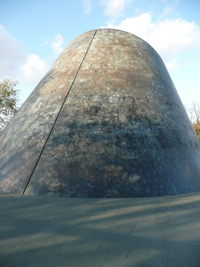
This line marks the local meridian.
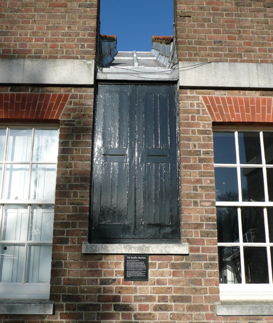
The observatory has had fifteen Astronomers Royal.
The 1st was John Flamsteed, the 2nd Edmond Halley, and the 3rd was James Bradley. The most
recent, Sir Martin Rees, is still in office.
Until then, star positions were determined using quadrants - a north-south graduated arc used to
measure a star's altitude. These were usually fitted with a small telescope.
James Bradley (1693-1762), the 3rd Astronomer Royal, had a meridian telescope built and carried
out the most accurate measurements achieved up to that point.
Meridian Instruments
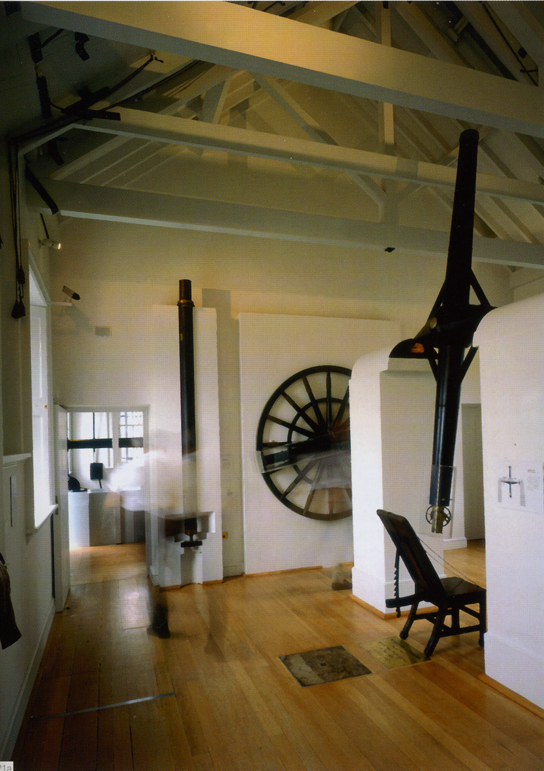
This 10-foot (3-metre) meridian telescope, also known as a transit instrument, was installed by
Bradley.
From that point until 1850, it defined the meridian of Greenwich.
When the Airy Transit Circle Telescope came into use in 1851, it broke all records once again.
This instrument was placed 30 feet (5.7 metres) further east, creating a time difference of
1/50th of a second - though that couldn't yet be measured at the time.


In 1884, it was internationally agreed that the local Greenwich meridian would be used as the reference for the entire world. From that moment on, East and West meet here, and Greenwich time became GMT.


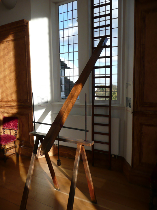
But before things reached that point, a great deal of measuring and calculating was done with far more primitive instruments.

The interior has changed little since 1675 - all the original instruments are still in place.

John Harrison's Marine Chronometers

Clocks remained a real problem. For the observatory, this was the best clock available at the
time - made in 1676 by Thomas Tompion.
A timekeeper suited for maritime use didn't exist yet.

On the left: H1 (Harrison I).
When three naval ships were lost in 1707, it was the final straw. A prize was announced for a
method to determine longitude accurately at sea.
20,000 pounds for an accuracy of half a degree.
John Harrison spent years working on the problem. Being an outsider, he was obstructed at every
turn.
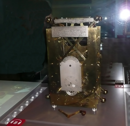
On the left: H2 (Harrison II).
A wonderful BBC drama was made about this story: 'Longitude' - highly recommended!

On the left: H3 (Harrison III).
In total, Harrison received 23,065 pounds for his work on the clocks. He received it in stages:
4,315 pounds from the Board of Longitude for his work, 10,000 pounds as an interim payment for H4
in 1765, and 8,750 pounds from Parliament in 1773. This gave him a reasonable income for most of
his life. In the final decade of his life, he became the equivalent of a multi-millionaire in
today's terms.
The Great Dome and Telescope
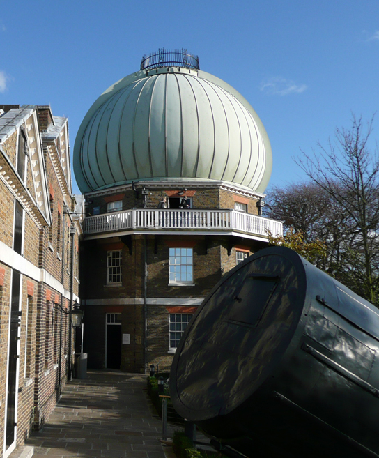
We also saw the beautiful sundials in the garden and on the buildings, but I'll cover those in a
future 'sundials' chapter (still in the works!).
Now let's head into the great dome, seen here with Herschel's telescope in the foreground.
The dome replaced an earlier cylindrical structure. It's made of steel and was originally covered
in papier-mâché! Today it's covered in polyester (fibreglass).
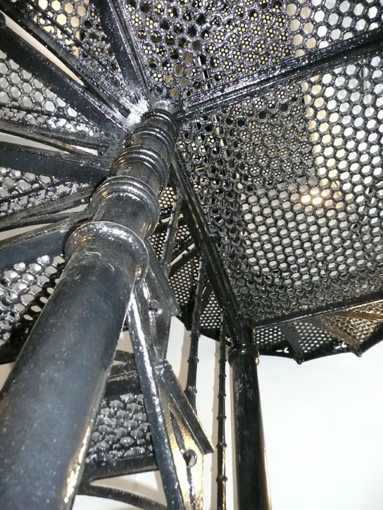
You reach the dome via a beautiful cast-iron spiral staircase.
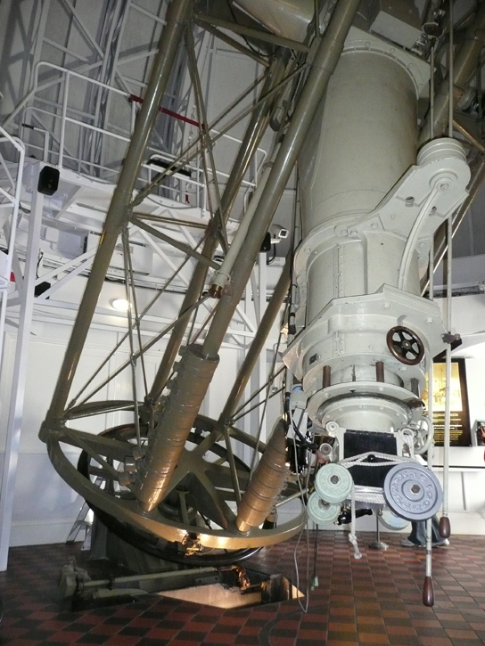
Originally (1850), a Merz telescope stood here, beneath the cylindrical dome.
The current telescope is a 72cm (28") refractor, built by Howard Grubb. It was put into service in
1893.
The mount - an English mount - has remained unchanged.


We head back as darkness begins to fall.
It had been a wonderful day.